Showing posts with label demolition. Show all posts

Monday, 21 November 2011

MOOVING ON DOWN TO THE COWGATE

If you backtrack to 24th October 2011 when I posted 3 pictures from around the Cowgate, you'll be able to see many of the buildings that were in these settings in 1970, just before demolition commenced.
The top photo here, taken in the early/mid 70's after demolition, has the area around King Street visible and as you can see, it was turned into a temporary car park before the new construction started.
The picture taken in the Cowgate, if you compare to the October set, you will notice that a huge chunk of the original buildings have disappeared from this location too, and again, a part of it turned into a makeshift car park - you can just make out Wishart Arch poking through in the distance. This image above was captured in September 1984.
Top photo from Gordon C.
Bottom photo by Neale Elder.

Sunday, 20 November 2011

VANISHING VICKY - EARLY 70'S

Another group of photos from the early 70's showing the demolition around Victoria Road.
Top picture is of the upper area of the Vicky.
2nd image, from the edge of the crater, was taken in Charles Street off the Wellgate. The derelict building at the opposite end, was the Kings Road location.
The 3rd view is where the buildings I displayed on yesterdays post would have been positioned.
Lastly, a look back over from the other side - the photographer was standing in Kings Road at the time.
Photos from Gordon C.

Saturday, 19 November 2011

VICTORIA ROAD BACKIES - 1970

A couple of interesting photos showing the back of the buildings along Victoria Road.
You may recall a similar view of this section of the Vicky I posted back in November 2010, but the difference is, on last years, the buildings were all empty - on these 2 photos here however, there is evidence that they are still being lived in.
The pictures were probably taken around 1970ish, so they didn't have that much longer to go before the arrival of the bulldozers.
The top photo shows the segment where it joins onto Idvies Street.
The image below it is further down a wee bit going towards Wellgate, with the tell tale sign of life - the washin' hingin' oot!
Not quite sure what the small building in the foreground beside the lampie is mind you, because I don't know what address it would come under. If it's in Charles Street then the only place that crops up in my 1970 directory on that side of the street is D. Todd, a coal dealer. Could be - could no be - hopefully maybe one of you will be able to nail that one.
Photos from Gordon C.

Saturday, 5 November 2011

THE DISAPPEARING CORNER - 1980'S

These images were all taken around the corner wedge area where City Road meets Milnbank Road.
Most of the main buildings you can see in the photos have vanished, replaced now with landscaping.
If you want to do a Google Street View comparison, here are their locations.
Top pic - Baxter Street shot from City Road in April 1986.
2nd pic - Baxter Street looking back down towards City Road in March 1984.
3rd pic - Blyth Street on a rainy day in November 1984.
last pic - The back of Blyth Street and Fleuchar Street in February 1985.
Photos by Neale Elder.

Thursday, 3 November 2011

HILLTOWN DETAIL - 1970'S

A couple of snapshots showing a section of the Hilltown taken around the mid/late 70's.
On the top photo, the photographer was standing in Stirling Street looking over at a few shops near the corner of North George Street.
The dark terracotta coloured premises on the left is The Auld Dundee Pie Shop owned by David Wallace. Next door is G.Page, shoe repairs. The small stone building with the large chimney stacks is Robert Gibb who was a joiner/DIY supplies shop, and the store catching the sunlight on the corner is the Co-Op.
This small group of buildings is still there today, although the shops are now different.
On the other photograph, however, the buildings further up past the Auld Dundee Pie Shop, have all been demolished.
Photos from Gordon C.

Wednesday, 2 November 2011

ACTING TROUPE IN HILLTOWN - 80'S

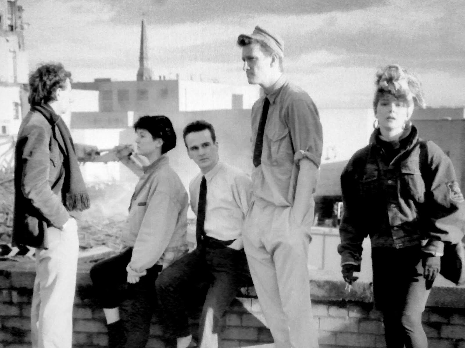
This is an acting troupe posing near the demolition site of the Tap O' The Steps pub on the corner of Hilltown/Victoria Road, sometime around the mid/late 80's.
That's Alison Burns far right, and possibly Derek Thomson far left but not too sure who the others in her company are.
Just wondering if this might be the group of actors who performed up at the DRCU in the Hilltown before Alison joined the more well known Wildcat cast.
All a bit hazy, but if you think you can supply further details, feel free to drop them into the comments.
Photo by The Bear.

Friday, 28 October 2011

3 GLIMPSES OF CHARLES STREET - 70'S

Here we have 3 shots taken in the early 70's showing the area around Charles Street.
Top image is the upper stretch of the Wellgate with Charles Street junction on the right.
Some of the shops around this location, such as Ken's Bazaar (far right) have called it a day and have the boarding up, while others seem to be hanging on in there just a wee bit longer.
The middle image is from the remains of Charles Street looking back over to the Wellgate. The street itself was connected to Idvies Street which would be further back behind the photographer.
The street sign visible on the building on the left is Charles Lane.
The bottom picture's view from the Hilltown reveals that the demolition work has nearly reached the corner of Charles Street, and so almost the end of its existence.
Photos by Gordon C.

Wednesday, 20 July 2011

BOB MACKAY'S - WESTPORT - 1960'S

Officially, this pub was called The Great Northern Bar, but the locals who drank there just referred to it as Bob MacKay's.
The photo was taken in the 60's at a location that no longer exists - the corner of Westport & North Tay Street.
For those of us (like me) who didn't socialise until a little later in the 70's, this spot here was the big car park space beside the Barracuda.
At the time of the photo however, it was the JM Ballroom that was just a few doors up from it, so needless to say, despite it being considered a bit of an old mans pub, the young set would often pop in for a couple of pints before nipping along to the JM.
The pub, along with the rest of corner area, was demolished in 1968.
Photo from Gordon C.

Tuesday, 5 July 2011

ANN STREET ACTIVITY - EARLY 70'S

These 3 pictures were all taken along Ann Street in the early 70's.
The top image is the calm before the storm as it was snapped just before the main part of the demolition commenced.
The Heatherbell Bar was still open for business in January 1972 but by 1974 all these shops and tenements had disappeared.
The middle shot is further along the street where you can see an old building being demolished behind the modern block. If you go back to the top photo, it's still standing.
Photo 3 is looking back along Ann Street in the other direction with Ellen Street corner behind the JCB that has just reversed into a shop!
Photos from Gordon C.

Saturday, 2 July 2011

DISMANTLING VICTORIA ROAD - 1988

They seemed to be going a bit canny with the demolition work at Victoria Road when this photo was taken on 19 Feb 1988. Perhaps this was the "snaffling the lead tiles off the roof" phase or something!
Anyway, the area in shot stretches from the Butcher on the left (#24) to the Knitting Centre on the right (#38).
I can't make out all the shops but the Central Cafe is there, also Chima, who sold saris and suchlike.
I remember in the mid 60's the 2 Chima daughters were the first Asians to enrol at Balerno Primary School, with Ravi Chima coming into my class.
The other feature in the picture is the lamppost at the top of Wellgate steps, referred to as the Bobbys Helmet.
And if you are in a particularly silly mood, you could do a double take and view the photo through surreal eyes where you might be able to see a wee gnome repairing the inside of the light!
Photo by Neale Elder.

Friday, 1 July 2011

GOODBYE MID STREET - 80'S

It's not just only buildings that disappear, sometimes it's the entire street, and here we are in the 80's bidding farewell to Mid Street.
Mid Street ran from the Dudhope Street/Hilltown junction, through to Constitution Road.
Top pic is from the Hilltown fork, Dudhope Street off to the right, Mid Street being demolished on the left.
The other photo is from Mid Street looking back over at the Hilltown.
It was time for it to go to make way for the Marketgait tunnel.
Photos by The Bear.

Tuesday, 28 June 2011

CENTRAL FIRE STATION DEMOLITION

The retro decades in particular were pretty active when it came to demolishing Dundee's old buildings, so much so that sometimes we thought the Councils motto was "What goes up, must come down"...(well, apart from their salaries!).
There was also a fair bit of new construction going on too, so over the next few days I'm going to put up a mix of images showing some structures going up, and some tumbling down.
Kicking off with this one here which is Bell Street Central Fire Station being knocked down in the late 60's.
The photo was taken from Courthouse Square looking over into the firemen's living quarters above the main station, with the entire corner area bulldozed.
Below the snap of the rubble is a photo of the fire crew who worked at Bell Street Station in the 60's.
It was sent in by Mark Ritchie whose father is the chap top left in the picture.

Bell Street was such an apt place-name to have a fire station too don't you think?!

Demolition photo is from Gordon C.

Saturday, 30 April 2011

OLD STAMPING GROUND - 1982

I forgot all about this wee shop until I saw this photo - Dundee Philatelic Supplies at Sinderins, on the Perth Road / Hawkhill junction.
Can't say I was ever in it mind you, but passed it often enough.
The shop itself was being stamped out at the time of the photo which was taken on 23rd September 1982.
The corner seated area still remains today, but the wedge of shops that are boarded up, have all been demolished.
And is that a couple of Harris pupils plunking? Surely not!
The 3 white posters on the boards are for Hot Chocolate, who were playing at the Caird Hall in Sept '82, a review of which can be found in the Nov 2009 Retro Archive.
Leading us nicely into the start of another music theme in May.
It'll be mega. So stick around!
Photo by Neale Elder.

Tuesday, 12 April 2011

THE HAWTHORN - LATE 80'S


This was the moment The Hawthorn's roots were wiped out forever.
Did they shout "TIMBER"?
With it went the other pub in shot on the corner of Victoria Road, the Top O' The Steps.
All gone!
Photos by The Bear.

Wednesday, 26 January 2011

BLACKHEATH PLACE / HAWKHILL - LATE 70'S

Following on from yesterday's disappearing streets, here's another one that no longer exists - Blackheath Place. This was on Hawkhill between Annfield Road and Ure Street, pretty much opposite Mid Wynd.
The wire fence, bottom left, was a car park area.
In fact, everything in the picture has now gone. The same location doesn't look anything like this now.
A nice touch with the Players No 10 advert though. It's like someone being granted their final request to have a cigarette before being executed!
There's a possibility the photo was taken in the early 80's, but I've settled for late 70's. Bit of a guess.
And no traffic...unlike the items next!

Sunday, 7 November 2010

WILLIAM LANE STEPS - EARLY 70'S

William Lane ran from Victoria Road down to King Street.
It consisted mainly of the steps in the photo, although there was a wee bit of road at the bottom of the lane before reaching King Street.
The building on the left of the steps photo (or to the right of the billboards on the top photo) was a stone engravers called Carnegie & Son. It's a place I remember passing on the bus regularly as a youngster because it's window display was made up of gravestones. No need to stop off there with your pocket money!
You can consult yesterdays map to find the location of William Lane. It was to the left of Dens brae, opposite Wellington Street.
I checked Google's satellite map, and if you zoom into the area you can still see the ghost of the steps showing through from the undergrowth.

Saturday, 6 November 2010

VICTORIA ROAD - FRONT & BACK - EARLY 70'S

This stretch of property was on Victoria Road between the Wellgate and Idvies Street (now Ladywell Ave).
The rear of the buildings would normally be hidden away from view because they were surrounded by tenements on all sides, so the shot of the backies is quite a rare sight.
To help you with your bearings, the building to the right with the large extensions on the back, is Forbes.
Also in the backies image is the church on the far right which was across the street at Eadies Road, and is now where a block of flats is.
The picture of the back of the tenements is a great one to zoom into on the large version. Lots of ancient nooks & crannies connecting the jumble of buildings to nose around. Not too sure what's what mind you - outside toilets, sheds, dovecotes, stock rooms, who knows, probably a mix of all of these. Just looks like a huge inviting adventure playground for a 7 year old kid!
By the mid 70's it was all gone and has since been replaced by free lodgings for birds - trees!
I've included a map of the area to give you a reminder of the layout back then.
If you'd like to recall what this same stretch of road was like when it was bustling with business, there's a good photo from the 60's in the Retro Archives - 7th November 2008.
Click onto the images to view or download the large versions. 

Friday, 5 November 2010

EARLY 70'S DEMOLITION

I still have a small batch of photos remaining that my brother took in the early 70's around the city centre area, so thought I'd drop them in over the next few days.
Starting with this one here of 2 Trojan bulldozers shifting the rubble in Victoria Road.
No safety gear in these days, with the guy nearest wearing only a floppy hat! No dust masks either, so unless they had their hankies tied around their faces like we did as kids playing cowboys, then the 2 drivers would probably have pretty dusty lungs at the end of their shift!
There are quite a few photos from this period scattered around Retro, so if you want a wee reminder of how Victoria Road looked before/during & after demolition, there are a chunk of images to be found in the Retro June 2009 Archives.

Tuesday, 1 June 2010

ANGUS HOTEL - THE END


POTS ARE FORMED FROM CLAY,
BUT THE EMPTY SPACE WITHIN IT
IS THE ESSENCE OF THE POT.

WALLS WITH WINDOWS AND DOORS
FORM THE HOUSE,
BUT THE EMPTY SPACE WITHIN IT
IS THE ESSENCE OF THE HOME.
Words by Lao Tse
Photo by Neil Menzies

Saturday, 29 May 2010

CAROLINA PORT CHIMNEY DEMOLITION - 1984

2 photos taken in fairly quick succession, capturing the moment the 2 chimney stacks at Carolina Port Power Station were demolished.
The top, "chimney A" - bit the dust on 8th April 1984.
Below, "chimney B" - came crashing down on 15th April 1984.
Photos by Neale Elder